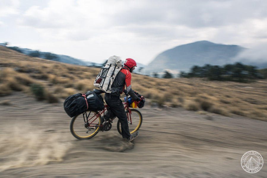
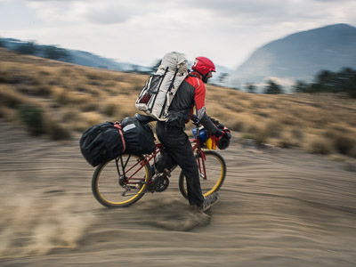
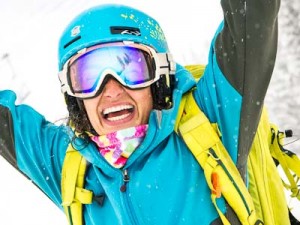
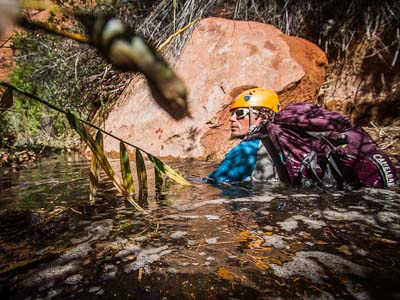
Windmilling his kayak paddle into the breeze, Luc Mehl, 34, pulls onto the sandbar at the mouth of Mexico’s Rio Antigua and squints at the novelty of a seascape horizon in the hazy afternoon glare. Two days of sleepless dysentery have drained Mehl’s prodigious vigor and his hands are blanched and clammy as we high-five. Still, he’s grinning with accomplishment in the salt air.
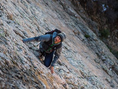
Eleven days earlier we’d set out pedaling bikes strapped with mountaineering and whitewater paddling gear in Cholula de Rivadavia, a ciudad sixty miles east of Mexico City. Without ever having visited Mexico before, Mehl composed a 220-mile bike/hike/packraft triathlon first to Pico de Orizaba (18,491 ft) and then descending through rainforest hamlets to a whitewater river. Now at sea level, we stand at the end of Mehl’s line. Continue reading →
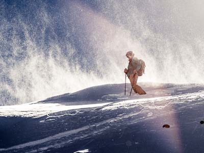
For a week each of the last 14 or so years, my dad, Jeff Harris, and I take a backpacking trip together. Usually we wait until the last minute to decide on an exact destination, following favorable weather. This year the forecast in Utah called for snow in the mountains and rain in the desert. It was a big enough storm that we’d have to spend a full day driving north or south to avoid it. Rather than do that, we packed rain gear and headed to one of Utah’s many wild deserts. Continue reading →
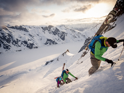
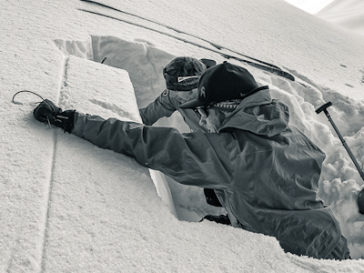
Ian wasn’t scheduled to fly in to SLC until 10pm and Neil wanted to run the idea by him first before committing. I’d proposed an early, early start so that we could ski down the East Face of Lone peak at sunrise, guessing that a 1:30am start would get us there around 7am. I also figured that Ian, just returning from a surf trip to the California coast, wouldn’t be interested in a stupid early start and I’d be off the hook for my dumb plan. Well, I was wrong.
At 11pm Neil called to say that he and Ian were game and we agreed to meet in at the mouth of Bells Canyon at 1am. After charging camera batteries and packing my kit, it hardly seemed worth it to bother with 45 minutes of sleep, so I puttered around listening to the ipod at high volume, waiting until it was time to leave the house.
The hike up Big Willow was on dirt for the first few miles, then supportable snow. As we got higher though, the refreeze crust got thinner and Ian and I would take a step, shift weight onto it and feel it give support until I lifted my other foot whereupon it would suddenly give, sending me thigh-deep into the mushy snow below. In soft snowboard boots, Neil was able to levitate up the crust a ways further before he too began the hip-deep wallow. I eventually submitted to the alpine crawl and then when the crust got thinner still, to skis, skins, and ski crampons.
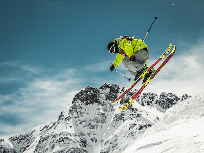
We topped out on Lone Peak, 6200 feet above the car, just after sunrise. It had been a warm night without much of a refreeze so we didn’t have to wait long to ski carveable corn down the NE Couloir of Lone Peak. Given the tremendous snowpack in the Wasatch this year, the couloir skied more like a face than a chute and the rock band at the bottom was so buried it was easily straightlined.
We skied down the rolling terrain of upper Bells Canyon for a mile or two before the snow became patchy. On principle, I linked patches of snow, skiing over shrubs and logs in the process, until the dirt sections were longer than the snow. Spring runoff was filling the trail at about 10cfs and we sloshed down the path disguised as a creek. A few miles of dirt stomping later and we’d walked back down into summer, where everyone was wearing shorts and giving our skis and snowboard funny looks.
The Provo’s put together a great edit of the adventure.
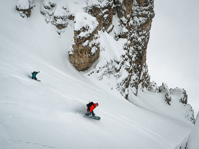
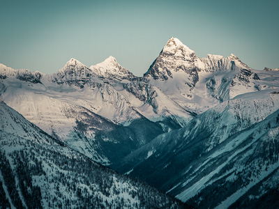
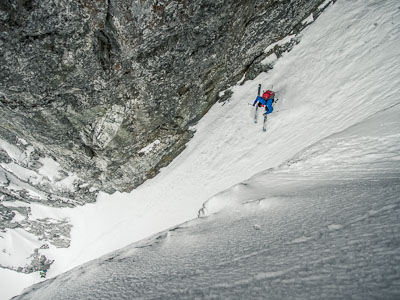
The North Face of Mt Timpanogos is a steep, seldom-traveled place. Andrew McLean and Brad Barlage skied a direct line decade ago before descending a poorly protected series of rappels down the 600 foot cliffs that stripe the lower face. Since then, the line has seen little action. Derek and I had eyed an elegant sneak down a tucked-away couloir in the cliffs on prior ski tours, but the face above was just too intimidating to try it on a whim. The windloaded, hanging snowfield below the summit avalanches frequently, often sliding to the ground. Unlike some areas on Timp, the North Face snowpack trends towards shallow and sugary.
This spring, after making and then aborting plans to ski the line a few times, Derek, Tom and I headed back. Cloud cover kept the spring snow from softening but the firm snow made me confident that we need not worry about avalanches. The Ali Babba sneak couloir was filled in, which I’m not sure happens every year. There was no need for ropework where the beta photo is marked “Rap.” The line we skied was something I’d envisioned for a few years and so naturally it felt great to ski it in safe conditions.
Mark often imagined lines down the west face of Cascade Mountain. Wide alpine bowls tighten to rock lined chutes before ending abruptly in a massive limestone cliff band that wraps for miles around the peak. The chutes are in plain sight of Orem and Provo, Utah but the wide band of chossy rock is unappealing to rock climbers and skiers alike.
After scrutinizing the cliffs with binoculars, Mark hypothesized that rappelling the cliffs might not be as bad as they look. Some bands of limestone appeared to be more solid rock, maybe rappelling them wouldn’t be so bad.
Armed with Mark’s brother’s bolt gun, a handful of rap anchors, and a comical quantity of rope, we climbed Cascade and ate a mid-morning sandwich while we waited for the snow to soften. The snow was icy on top, covered in roller balls through the middle and didn’t get good until about the last 1000 feet of silky corn skiing. While the route isnt steep, it’s hard to forget about the huge exposure below.
When we reached the end of the snow, where ramps of steep loose talus alternated with crumbling shale and limestone cliffs I began to rethink our plan. From below the steep benches weren’t apparent. On top of that, the best rock seemed to be just below the edge of the terraces which would make both bolting and clipping the anchors an intense chore. Mark had hoped, if we put in some well-placed bolts, that the route might gain some popularity. It certainly looks aesthetic from the valley. But if we were forced to drill over the edge the bolts would be near impossible for others to find.
A little disappointed, we reassessed then began moving towards plan b. We climbed over a nearby ridge and then began the long scramble down a ravine that cuts through the cliffs. The route was less direct than what we hoped for, but required only a few short rappels before we were booting down the pine-needle-and-tree-trunk-covered avalanche debris pile below the cliffs. Fat, old trunks violently deprived of all their branches and most of their bark were an unambiguous reminder of the huge slidepaths overhead. With skis on our packs, we thrashed through the spring greenery back to the car.
After getting rained out in Fruita, we headed back to Utah where the NWS was forecasting a foot or two of snow. Early Monday morning we put on boots and skins by headlamp and discovered that between the three of us we knew quite a few of the other folks doing the same thing in the parking lot around us. It had snowed two feet overnight but cleared and now the stars were fading into the dawn. Grant, Dustin and I skied a deep, bluebird lap down Monte Cristo and were headed back down LCC by 8am.
Back home from skiing, Grant and I loaded his truck with the bikes and car camping gear we’d just unloaded the night before and headed a 140 miles East to Vernal, Utah. By lunchtime we were back in tee shirts and shorts, riding bikes in the red desert.
Mark and I skied Crow’s Foot Chutes after I almost blew it by forgetting my boots at home. Luckily, I had a pair ordered and ready to be picked up at Black Diamond and I’d have to break em in sometime, right? Our mid-morning start had become a noon start so we decided to shorten the route by traveling straight up the South Fork of Dry Creek. 4400′ of trail-breaking later and we were on top of the avalanche paths, looking down on the suburban sprawl below. It’s always such a contrast to ski along the western edge of the Wasatch. Look uphill and there’s eagles and weathered old trees and zero human footprints, turn around and, woah, there’s two million people right freakin there.
The National Weather Service couldn’t decide what the storm was going to do. Two days out they were calling for 5-9″. By T-minus-24 they’d upped that to 7-14″ but then just as quickly backed those numbers way down when the front split around the Wasatch. So I was surprised to wake up and see Alta reporting 15″.
Sure the temps were well below zero with ridgeline windchill some scary number around -30F, but it hadn’t snowed much for a week and finding a couple powder-fixated partners wasn’t hard. Bundled warmly, we went for a tour.
The wind was kicking and it was carrying away plumes of the light density snow in a way that made it look like the mountains were burning. That wind was also drifting the new snow into slabs that we kicked off as we walked above them on the ridgeline. The final tally included occasional face shots and zero frostbitten appendages. Not bad.
We went south looking for cold, fluffy powder. Instead we found a thick melt-freeze crust under a dusting of new snow. The climbing was that challenging type of skinning where skis have to be edged just perfectly to get traction. Lean one way and you’re sliding sideways downhill. Lean the other way and, well, same result. It’s the skiing equivalent of climbing offwidth: usually unpleasant and insecure but punctuated by moments of enjoying the challenge.
The ski down wasn’t really that much better. Dodging frozen debris chunks and jump turning runnels has some appeal, though you need to have a pretty obsessive appreciation for skiing to see it that way. It was probably good training for spring mountaineering, or something.
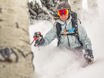
With a few inches of new-snow cushion on top of the rain crust, Allison, Alex, Grant and I went out to see if we could find some decent turns. We succeeded.
Allison pointed out to me tonight that Timpanogos is a Ute word meaning rock (tumpi-), and water mouth (-panogos). That got me googling and it wasnt long before I came up with this page from Southern Paiutes: Legends, Lore, Language and Lineage. If you haven’t read about the possible origin of the word “Wasatch” it’s worth clicking that last link.
Anyway, today we walked up the East Peak of Timpanogos, or Peak 10791, or Elk Point, depending upon who you ask. Climbers on summitpost claim guidebook author Kelsey labeled the point East Peak of Timpanogos in his books despite the pre-existing name Elk Point. But then Derek and Bruce Tremper agree Elk Point is the outcrop a bit further south, just above Sundance. So who knows. Anyway.
We skied the prominent, fearsome-looking avalanche path on the NE corner of watchamacallit after looking for something even more billy-goat to ski. The snow was variable and, notably, punchy in places. Down lower the powder was still cold and soft but the near surface facet layer is 6-8″ deep, loud, and loose. The snow in this area is loosing strength, as both the top and bottom of the snowpack metamorphose. All it will take is a windy night or a couple inches of snow to turn this slope into the loaded gun it often is.
We skied the big gut-shot off the summit in the photo below. That’s mostly ’11/’12 gear you see the boys sporting there. Sorry, but you’ll have to wait to see it up close.
I’d classify the route as “adventure skiing” which in my lexicon implies a dose of exploration, routefinding, and perhaps less-than-ideal snow. While there aren’t many days in a year I feel bold enough to venture into the funnel we skied, terrain knowledge from today will be helpful the next time I do.
We made a couple frosty laps on Santaquin Peak yesterday. The route up the west gully begins in a neighborhood. Despite the low elevation start we were spared bushwacking. Apparently the drainage avalanches cataclysmically often enough to keep the gully clear right down to the resident’s back patios. The skiing was Argenta-esque with a pleasant upper-30 degree headwall for about a thousand feet followed by another 3500′ of low-30 degree meadow skipping through avalanche-abused shrubbery. Certainly the highlight of the skiing was high-marking and shrub-jumping down the 1.5 mile long half-pipe gully. Good times, boys!
Two years ago, Derek pointed out a pyramid-shaped face on Timpanogos as we skied along the ridgeline. We peeked over the edge but, because the line gets steeper and steeper the lower you go, we thought it might cliff out at the bottom and skied elsewhere that day. We didn’t make it back to the pyramid face that year, or last year, but after a recent storm plastered 13″ of water, all of it in the form of snow, we figured it’d be worth investigating the line again. After a not-nearly-long-enough 3.5 hour sleep, I motored an hour down the valley to meet Derek, Tom, Noah, Andy and Alex. As Derek pointed out, it’s a good sign when everyone shows up early for a 5:15am rendezvous.
We began skinning in the dark and wound upwards through the Grand Staircase as dawn broke. As we climbed above treeline we got our first views of the east face of Timp’s north summit – the line we hoped to ski. Following a mile of rideline walking we crested the summit a bit after 11am. The sky was that deep-sea blue that happens on crisp January days when the sun’s orbit is still low in the south – the same sky you see through the little round window when cruising at 35,000 ft.
The route down was similar to the east face of Twin Peaks here in the central Wasatch – similar steepness with lots of rocky outcrops and gully options across the wide face and about the same vert too. Unlike the east face of Twins, the bottom of this route cliffs out in a big way. We traversed off the face above the 200+ ft cliffs glad we’d saved the mission for a day with really, really, really high snow stability.
We caught glimpses of the full moon tonight between gusts of hissing snowfall. A bit more than a foot had fallen during the day and it seemed to be composed entirely of high-density graupel. Still, the graupel was loose and flowed like large grain sugar between gloved fingers. Its higher density bouys skis to the surface and we bobbed down the runs, kicking up rooster tail wakes that sounded like rainsticks. We finally called it quits around ten then adjourned to Main St to add some GoreTex chic to the Ed Hardy-swaddled crowds.


 Mark and I skied Crow’s Foot Chutes after I almost blew it by forgetting my boots at home. Luckily, I had a pair ordered and ready to be picked up at Black Diamond and I’d have to break em in sometime, right? Our mid-morning start had become a noon start so we decided to shorten the route by traveling straight up the South Fork of Dry Creek. 4400′ of trail-breaking later and we were on top of the avalanche paths, looking down on the suburban sprawl below. It’s always such a contrast to ski along the western edge of the Wasatch. Look uphill and there’s eagles and weathered old trees and zero human footprints, turn around and, woah, there’s two million people right freakin there.