October Harvest

The alarm went off at 3:55am but it wasn’t hard to get out of bed.  Looking out the back door I noted that the patio furniture was freshly buried. More than a foot of snow had fallen overnight and that was down here in town.  High in the Wasatch several feet had drifted in, filling gullies and ironing talus fields wrinkle-free.

It was dark when Ian and I started breaking trail uphill and just light enough to see without a headlamp when we peeled our skins at the top of the first run.  The stump and rock-covered ground was still only a few feet below and I made tentative turns.

After yo-yoing over ridges we zagged up into the clouds, our zigging trail hidden in the fog below.  On top of the peak we waited for the clouds to break.  Eventually they did, turning the sparkling snow searingly white.

I dropped in, still cautiously, and heard that fingernails-on-blackboard sounds as my ski edge scraped over rock. As the gully narrowed the snow got deeper and I was gliding down though powder as it billowed around my legs and chest.

For the first day of the season it was remarkably deep and I think set a personal record for tiredness of hip-flexors.  A vertical mile of trail breaking will do that, I guess.  It must be ski season because my pedal-bite scabs had all disappeared (presumably into my socks) when I peeled off my steaming boots.

High Uintas Wilderness

My dad and I head out for a trip each year, just the two of us.  The past couple years we’ve planned to head into the Uintas but make last minute re-routes when the forecast inevitably begins projecting two feet of wet snow.  So, we’ve ended up walking desert canyons the past couple years, chewing carefully to keep the sand-crunching to a minimum.  If there’s a breeze in the Utah desert it’s pretty much impossible to keep sand out of whatever’s cooking.

This week the forecast called only for a little shot of cold-n-wet and so we decided to pack for 15-degree nights and finally go for a walk together in the Uintas.  Allison and her dog Rudy hiked with us for the weekend then headed back to the M-F grind while we trucked on.  With the exception of a couple snow/rain/hail squalls, the weather was awesome with sunny 50 degree days that gave to clear frosty nights.

The literal high point was a walk up snow-dusted King’s Peak.  At 13,528′ it’s the highest choss pile in the state.

As always, it was great to catch up with my dad and also to spend a week on the loose in the wilderness without passing even one other group.  As we drove away from the trailhead, dark clouds began to circle in from the west as the first big snowstorm of the season approached.  Perfect timing.

Rampage

The Rampage is a spectacle: it’s spectacular spectating.

Mountain bike riders careen down the mountain, hucking off cliffs and jumps while choosing a route that will impress the judges watching from below.  To that end, Red Bull and the riders build themselves personalized jumps and buff out landings below jumbo sized cliffs. Then they push their bikes to the top, saddle up and bomb down.

Redbull might have chosen a tag line less jinxy than “the land will rumble again” for the 2010 Rampage if they’d known what the weather was planning.  On Saturday, while the riders were finishing their prep for the following day’s competition, a nasty little storm rolled in sending vendor tents flying as athletes scrambled for lower ground.

We were out for an evening ride when the sky turned from mildly overcast to murky orange and menacing.  The strengthening t-storms were churning the desert sand and filling the sky with plumes of Zion dirt.  Steering down the trail became interesting as powerful gusts pushed us sideways into the sagebrush.  With lightning striking the ground only a few miles away, we pedaled the trail in record time.

Sunday was lined up to be a repeat of the day before: a few little dawn cirrus clouds were joined by happy little cumulus cottonballs.  Suddenly, the purple underbelly of a cumulus nimbus rose from behind a nearby ridge, coughing out distant rumbles.  It tracked straight towards the Rampage venue.  Wind began snapping the Red Bull flags sprinkled along the cliffs and then the guys next to me tied bandannas across their faces.  The next two riders crashed when gusts carried them away from the transitions they aimed to land on.  The event was postponed.  Wind hold, they announced as fat rain came in sideways.

It rained and stopped, rained and stopped, cleared again, rained once more, then, when I was sure the weather had soured for the day, suddenly went blue.  The helicopter took to the air and the athletes soon followed suit.  The event finished without any serious injuries to any riders.

Continue reading

Map’s Edge

From Idaho, we motored north on Highway 93, into Montana and my old stomping grounds in the Bitterroot Valley.  I bored Allison reminiscing about ski adventures gone awry as we passed Trapper Peak, Como and El Cap, Sky Pilot and Gash Point, Saint Mary’s and Saint Joe and finally Lolo.  Looking back, it’s pretty incredible we made it through all those descents relatively uninjured given how uninformed we often were.

Pedaling around Missoula, I was impressed by the places that haven’t changed a bit, like Charlie B’s, Del’s, and the Oxford, and less so by the new developments that are totally different from what I remember.  We didn’t have nearly enough time to catch up with all the people I wanted to see but did manage to fit in a ride with some old pedaling buddies.

As our bike-laden Honda pulled into the trailhead lot an hour out of Missoula we attracted glares from the horse folk who were standing around campfires near their trucks while waiting for the morning sun.  After our bikes were unloaded in the grass one of the cowboys wondered aloud whether bikes were even allowed on these trails.  Isn’t this area Wilderness?  Well, Scott explained, not yet; not Wilderness just wilderness.  The area is one of many in Montana that’s being pushed towards Wilderness designation and when that W gets capitalized bikes will no longer be allowed.  For now though we’re free to explore the hundred-plus miles of trail that branch from the trailhead.

Still a little jelly-legged from our rides the previous days in Idaho, we talked Scott and Sean down from the mega-loop extravaganza they’d been eyeing.  We settled instead on a mellower sub-30 mi jaunt.  The trails in Missoula had dried completely from the week’s rain, but out here in one of the wettest parts of the state the air was still heavy with humidity and the low spots still mucky.

We pedaled up through Doug Fir forests then into stands Larch and Spruce. Next came dark Cedar forests with giant old-growth towers that dimmed the mid-day light into dusk.  My tires bumped over horse hoof prints until we passed the point where they’d turned back.  Here the trail was smoother and only the faint traces of horseshoes remained after days of rain.  Instead crisp prints in the sticky spots were from deer, elk, moose and wolves.  The wolf tracks were especially interesting because there were a lot of them and some of them looked very fresh.  Allison, who’d been bringing up the rear of the group, expressed her nervousness:

Do wolves ever bother people?

Not that I know of, but that was barbecue-flavored sunscreen I gave you, so you never know…

The wolves must be fans of dry rubs instead because we never saw them.

Eventually the old growth grew shorter and more spaced as we approached tree line, which is only about 6000′ here.  We crossed the state line into Idaho, refilled empty water bladders at a lake inlet and enjoyed the indian summer sun.  The ride back down was long and tacky.  The yellowing leaves whooshed against my handlebars and arms whenever I’d lean my bike around a turn.  Slick logs, twisting trail, and hidden pedal-height rocks kept our downhill pace in check.

Back at the car with our dirty bikes, canned microbrews in hand, an old timer wearing dark denim wranglers and western boots ambled over to congratulate us on our ride.  Scott’s mountain bike ambassadorship from earlier in the day had already began to pay off.

Continue reading

Cloud Riding

Hanging out at the coffee shop in Wilson, Wyoming we were displeased see a line of rain clouds stretching across Montana’s extended forecast.  We’d hoped to spend several days riding remote trails in Big Thigh Country but neither of us wanted to camp out in a wet, slow-moving Pacific front.

Allison had prepared for this kind of thing with a collection of maps for other places.  More or less at random, we picked an area in the White Cloud Mountains in central Idaho that had a number of long trails looping from end of a dirt road and off we went.

We didnt have much information about the area, just the topo maps, and maybe because we didn’t quite know what we were in for selected a 40-some mile singletrack link up.  This morning I found a guidebook reference for a smaller variation of the loop that mentions “you’ll be praying to the endurance gods for forgiveness.”  And that’s true.  But, it was also some of the flowiest, narrowest singletrack one could hope to ride.  We just had to earn the long downhill with two dozen miles of loose uphilling punctuated by hike-a-bikes.  The ride through winding pristine valleys was worth the fatigue.  Back at camp that night we drank cold beers and soaked in hot springs along the river.

The next day we rode a more popular loop, though after looking at the trailhead register it still looks like it only gets a few bikers a week.  The Big Boulder to Little Boulder Creek loop climbs 3500′ before dropping over a pass and down to a chain of alpine lakes.  From there it contours along a high bench for a few miles before dropping the remaining elevation back to the road.  This trail was wider, blown out in spots by motos and horses.  Still, there were miles long sections that were ripping fast with plenty of little root and rock drops to keep a me focused.  Plus, the scenery is amazing.

Here’s photos:

Continue reading

Roll the Coaster

“It’s easier to ask forgiveness than it is to get permission” -Grace Hopper

Back in 2003 we got permission from the Forest Service to construct mountain bike stunts along an existing trail near Missoula. Following a few years of cat and mouse games as illegal trails were built, discovered and destroyed, the bike community began working to earn the trust of the Forest Service. Once permission was granted we focused on accommodating their rules dictating how stunts could be built. The stunts weren’t exactly what we would have crafted given free reign but, hey, at least the trail was legit.

Hundreds of hours went into building log rides, jumps, drops and berms along the trail. The District Ranger personally inspected our work and approved. It was one of the first legal freeride trails in the US.  Deadman’s Ridge Trail made it into Bike Magazine and the stunts are shown in this IMBA/USFS trail-building DVD.

A year later, the Forest Service District Ranger position changed hands and the replacement chainsawed the stunts to bits without warning.  The bike community was furious.

Work on Deadman’s had concentrated the energy of the community and now that the trail had been dismantled groups of builders splintered and half a dozen new pirate trails were soon under construction. Better to ask forgiveness…  But, with a return to building in secret, the cohesiveness of the community evaporated.

Once a couple hundred riders strong, the freeride scene in Missoula has fizzled. Missoula never became the freeride destination it was briefly poised to become.

That anti-climatic story runs in contrast to the story of Teton Freedom Riders. Their story begins the same: a small group dug illegal skid trails until dog-walkers discovered them and alerted FS Rangers. Like in Missoula, there was initial controversy then eventually riders organized and gained legitimacy. The asking forgiveness strategy worked.

Again like in Missoula, they bargained with the land managers. Some trails were closed in exchange for allowing others to remain open. Unlike in Missoula, the regional Forest Service leaders never reversed their decision; the community was never pushed back into secrecy.

In Jackson Hole, the community’s relationship with the Forest Service has flourished and along with it the trail network has grown.

We spent four days lapping the well-crafted trails. I crashed more in those few days than I have in the last couple years combined. Slowly I wrapped my head around the sequences, re-awakening dormant muscle memory. It was great.

Slot Shots

Utah’s slot canyons are high-contrast places.  Cold, rough sandstone appears warm and flowing; noon sun is intensely hot while deep in the perma-shade of canyons the temperature is 40 degrees colder; cameras have a rough time metering where murky shadows are split by high-watt beams of sunshine.  And then there’s impracticality of keeping delicate, expensive cameras dry in a wet, sandy environment.

Rather than acting as deterrants, I suspect the high-contrast qualities of southwest Utah prompted photographer Steve Lloyd to propose a photo-centric trip to Escalante National Monument.  Steve had a vision for a complex shot and set about finding a reliable group to help bring the image to fruition.  Kevin Brower, Steve and I drove south, stopping for a quick sunset bike ride before meeting with Nick, Joe and Jordan later that night.

Escalante is, by desert standards, incredibly green this fall.  Everything is blooming and the fine red sand is a storyboard of foot and tail prints from chipmunks, mice, lizards, toads, spiders, snakes and scorpions. And ants.  After a very snowy winter followed by a rainy summer, the ants are having a banner year.  We chose to camp in the middle of a sprawling ant metropolis.  Pulling my gear out of my pack this morning I discovered dozens of ants that had hitchhiked in the folds of my sleeping bag, the corners of my wetsuit and others that had insinuated themselves inside sealed ziplock bags.  Yes, it’s been a wet summer in the desert.

With huge flash floods freshly recorded by stickjams high in the trees, the slots canyons are full of water.  This means that canyons potholes, which can sometimes be difficult to climb out of, are brimming full and easy to escape from right now.  It also means that long sections of the canyon we descended were flooded.  We doggy paddled thought the funky water for long sections, fingers crossed that submerged cameras were staying dry.

Steve shot the location he had envisioned and came away with bunch of beautiful images.  I got to watch a real-deal photog setup and manage the scene of a difficult shot.  Plus, we all got to slither and swim down a beautiful little canyon. Mission accomplished.

Sunset Boulevard

Kicking off this long weekend, the Avett Brothers concert turned out to be a rowdy, high-impact type of night.  On Saturday morning Allison and were moving half-speed.

Rather than motivate to head out for a long ride we drank agua by the liter and tinkered with bikes.

Finally we rallied for a night ride on the Wasatch Crest Trail.  The sunset was fiery and as the light faded we turned on bike lights and rolled into the dark.  One might think this is an unusual way to spend a Saturday night but on the ride down we ran into Ian, who also seemed to think riding in the dark is a worthwhile use of weekend.  In fact, it was an excellent use of a Saturday night.

Sunrise Ride

The last couple days in Park City have felt like fall. Yesterday morning started off with a literal bang as thunder boomed over the ridgeline so we postponed our plans for a sunrise ride. Today we were out the before sunup and had the trails to ourselves.   After yesterday’s rain and snow, the trails were smooth, tacky, and fast.

Wasatch Perverse Traverse

“Ha! You’ve got to be kidding me!” was Noah’s email response to a note I’d sent asking if he wanted to link up Mt Olympus with Twin Peaks. He attached a map with a red line he’d just then been drawing that connected Olympus to Twin Peaks to Lone Peak. My first thought when I saw Noah’s map was “That’s huge!” my second thought was “…well maybe.”

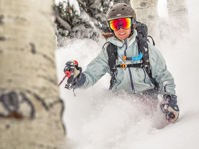
Yesterday morning we left the car at 4:30am and started up Mt Olympus. It was a muggy warm night with a bright moon. I didn’t need my headlamp for light; rocks and trees were illuminated in colorless moonlight. I left the headlamp on my head however. The elastic band helped redirect the sweat that was already dripping down my forehead. It was going to be a long, hot day.


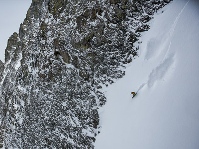
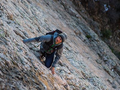
We were past Mt. Olympus when the sun first glinted on the peaks nearby. The ridgeline beyond Olympus is narrow and rocky and we ducked through bushes and scrambled along the ridgeline fins. Noah called out about a ground hornet nest I’d just passed, oblivious, when he was immediately stung. A rolling talus chunk bopped me on the knob of my ankle, leaving it feeling wooden and tender the rest of the day. As we ‘shwacked down towards Storm Mountain Amphitheater we heard a startling buzz.  Noah had stepped over a rattlesnake.

Mountain mahogany and gamble oak intertwine into an inflexible, woody understory and when we no longer found routes around the thickets we began plowing though. Despite temperatures that were climbing through the 80’s, I wished for a Carhartt one-piece. Even having long pants might’ve added some significant speed to our descent. Finally we reached the bottom of Big Cottonwood Canyon where we dunked our heads and soaked our feet before lacing up and beginning the next leg of the traverse.

That beard really helps him blend with the foliage


Climbing up Stairs gulch, a trail begins at the pavement but soon disappears among scree, slab, and briers. The sun was baking the dark rock under our feet and polished slab still thousands of feet above looked wet in the glimmering heat. High-stepping up divots in slab, I understood that Stairs Gulch was literally named.

Up up and away


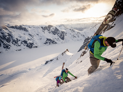
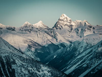
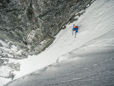
On top of the ridge, Noah’s altimeter had recorded 10,000 feet of climbing and we were slowing down. The final 1300 feet  along the ridgeline to the summit of Twin Peaks took us a full hour, far slower than the pace we’d held earlier. But finally we were looking a vertical mile down into Little Cottonwood. Sandwiches and cold drinks were waiting for us at the bottom. We just had to navigate down Lisa Falls to get there.


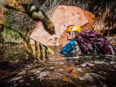
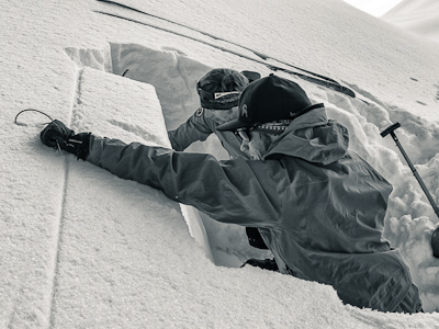
For the record, I’d like to say that I knew Lisa Falls had waterfalls – it’s right there in the name – what I didn’t realize is that over the course of it’s 5000′ run there are hundreds of waterfalls. Noah and I discovered this as we slid and handjammed down the couloir. We also discovered that, despite facing due south, there were some pretty big snow patches hidden in the recesses of the chute. The meltwater ran down the white granite, leaving the center of the gully mossy slick and limiting where we could downclimb.


We moved steadily downhill, stopping only once during the four hour descent.  Earlier we’d handed hiking poles over 4th and 5th class ledges, but now we’d begun hucking poles before climbing down to retrieve them. Then repeat. Again. And again. And props to Black Diamond’s poles. Despite the abuse they’re still fully functional, though they gained a few scrapes.  When my poles landed neatly paired without bouncing too far or clattering too much Noah nodded approval. Even after 14 hours on the hoof, Noah’s sense of humor is still sharp.


Finally, as alpenglow faded on the Y-couloir across the valley, we’d dropped into the deep twilight of the forest below Lisa Falls. At Noah’s truck we inhaled sandwiches and decided to save the Lone Peak to Draper section for another day.  In hindsight, every part of the hike except the climb up Olympus was significantly more difficult than we had anticipated.  The micro routefinding was endless and our unfamiliarity with the terrain (at least without a thick snowy blanket) hindered our ability to move quickly.  If we repeated the route I’m sure we could shave off several hours. Still, the route Noah envisioned could be beyond my ability, at least if the goal is travel from Olympus to Twins to Lone Peak between sunrise and sundown. But then again… well, maybe.

Bikeaneering

I’ve wanted to ride Mt Elbert, the tallest of Colorado’s 14ers, all summer and finally went for it today.  Beginning at Half Moon, the first few miles of trail are mostly climbing but with a few downhill sections to keep it fun.  From Lilly Ponds the climbing really gets going with a 4000′ uphill to the 14,433′ summit.  I wasn’t able to pedal much of that climb and pushed my bike more than I care to remember.

Here’s me on top of Mt Elbert with CO’s second highest peak in the background.

It was all rideable going down but rocky, lose and with plenty of hairpin turns.  Dodging loose toaster-sized rocks, it’s clear that the trail isn’t groomed for biking. I managed to stay upright the entire way but my hands needed a few shake-outs when my braking fingers started feeling crampy.  The riding was fun in a keep-your-speed-in-check, techy way but the slog up was enough to dissuade me from wanting to repeat it soon.

I happened to cross paths with a coworker on top and she volunteered to snap a photo as I started down. The lakes are 5200′ below.

Five years out, I still miss living a short pedal from Bike Doc.

Crestone Scramble

I first heard of the traverse between Crestone Peak and the Needle from Austin. He had just finished climbing the Needle’s Ellingwood Arrete and was enjoying the summit when a climber asked where the traverse began.  Austin pointed him towards the downclimbing that begins the route towards the Peak and was horrified when, seconds later, the soloist tumbled off the 2000′ face.

I decided to give the traverse a try in the opposite direction that the ill-fated climber took so that I’d be going up, not down, the hardest bits.  We’d been working on improving sections of the Broken Hand Pass trail with the Rocky Mountain Field Institute and Mark Hesse of RMFI, wrote out a succinct page of beta with just enough info for me to find the route.  An adventure was  guaranteed by the broad strokes with which he described the route.

It was Friday the 13th and I left camp just as a blood-red sunrise stained the summits. Fittingly, I hustled up the the trail labeled “Friday the 13th Pass” on the OB master maps then out a narrow ridge that leads towards the north couloir of Crestone Peak.  The gut of the couloir looked loose and gun-barrelish so I followed Mark’s directions and began climbing a face leading out of the gully. I moved quickly up the large cobblestone holds. Even though it was mid-August, it was below freezing in the shade of the summit and every once in a while I paused to rewarm stiff fingers.  Near the top of the N couloir I crossed the loose redrock chute, and moved up a rib into the sunshine and onto the summit of Crestone Peak.

I added a “Fri the 13th” salutation to the summit register then skittered down the south-facing Red Gully before spotting a carin marking the beginning the traverse towards the Needle. Linking grassy benches interspersed with 4th class conglomerate ridges led to the base of the Black Gendarme and the crux of the route.  The weakness in the NW face of the Needle consists of a steep funnel of a gully obstructed by fridge-sized chockstones. Instead of following that chimney, I soloed the 5.6 face of the couloir on steep cobblestones and thereby lessened potential for getting conked by round clasts falling from above.

A few hundred feet further up, the final pitch to the summit of Crestone Needle is 5.easy but with 2000′ of air beneath one’s sneakers. That kind of exposure is what understated climbing guides call “attention getting” and so I climbed methodically, checking carefully for loose cobbles before transferring weight to the clast. Back in the sunshine on top, the sky was cloudless and I ate a late-morning lunch and watched climbers grunt to the top of the Ellingwood Arrete.  Soon, other peak-baggers began reaching the summit and as I started down I made an effort to stay out of the gully that is the most popular route to the peak. The round clasts, remnants of an Ancestral Rocky Mountains riverbed, are easy to accidentally dislodge and loose upon climbers below.

Headed down Broken Hand Pass, I was glad to be back on a trail and out of the path of falling rocks.  The traverse’s exposure and big views had been exhilarating but also risky because a small mistake could have large consequences.  Back at camp I began my favorite backcountry celebration sequence: untied shoes, peeled socks, rinsed off grime, and sat in the sunshine making pizza dough.

Yampa Dilly-Dallying

Sepperated by jobs in different states, Allison and I found time to meet for a quick river trip about half way between Leadville and Park City. The “Wild and Scenic” designation of the drainage seems a bit over-hyped; there wasn’t much “wild” about the river.

The dominant exports of the valley are coal-generated electricity and stuff made from cows. We had front row seats for a coal-burning plant about a mile long that took us a good chunk of the afternoon to drift around. Its high-tension wires radiated outwards, humming softly as we bobbed under them. Cows are omnipresent, and so are cow pies. And that’s ironic because it makes the assertive signage about packing out human waste from this fragile n’ pristine ecosystem seem like, well, a load of shit.

Getting past the fact that the Yampa is heavily impacted by the industries that utilize it, the trip was pleasant. Both Allison and I tend to gravitate towards vacations that make our jobs seem restful and so it was weird to hear myself say “relaxing gettaway” while planning the logistics. Indeed, it was a lazy, slow-moving, dozing-in-the-sunshine jaunt. In the dialect of about everyone I work with, it was suuuper, suuuper nice.

Summer Solstace Slog

Allison and I woke up on longest day of the year in Crested Butte and decided to celebrate the day with a long ride. We pedaled up Washington gulch to the top of the 403 trail then began a technical descent that soon turned to a technial hike-a-bike through deep snow and over many trees felled by winter storms. Eventually we were back on dry ground for a few miles of dangerously fast singletrack followed by a steep trail section that took us skittering down onto the Schofield Pass road.

Against the advice of a fellow cyclist we pedaled up the road grade to the bottom of the 401 hill climb, where he’d turned around on account of snow the day before. What ensued was something of a suffer-fest as we handed bikes over piles of overlapping downed trees and slipped and slid up mushy snow in our skate shoes.

About 5000′ of climbing into the day, we were poised on top of one of the most glorious singletrack downhills known to mankind. We raced down the winding trails, which were extra fast on account of the wildflowers not yet being high enough to hide the next dip or swoop in the trail. Raising seatposts back up, we climbed up to the top of the second half of the trail but caught our breath as we headed downhill again.

More than two hours of dragging bikes through snow left us feeling more depleted than I’d hoped and linking up with Deer Creek trail seemed unrealistic, so we hopped on Snodgrass for a mellow but flowy four miles back around to Washington gulch. We counted down the time to camp during the last climb; I was totally fixated on the True Blonde Dubbel waiting for us in the cooler. And it was there chilled, and waiting for us.